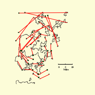
c
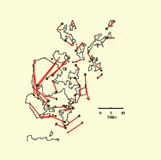
d
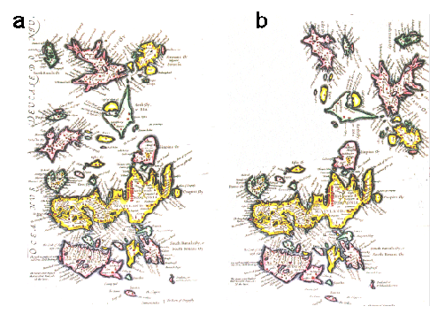
Fig. 1 Map by Blaeu 1654.
a) as published;
b) after rotation of the Northern Isles through 90 degrees;
c) and d) equivalent error diagrams.
The red lines on the error diagrams join the true location of each point to a square at its location on the antique map.