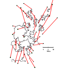


Scale
Error
The yellow map indicates the modern shape of Orkney
Click on the map to enlarge it

Go to next map
Go to corrected

Go to index


Go back

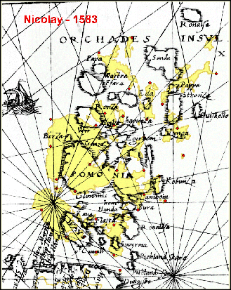
N de Nicolay - 1583
Vraye & exacte description hydrographique des costes maritime d’Ecosse, Isles Hebrides & Orchades
1 : 3,421,000
4079