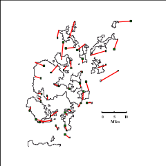


Residual Error
Scale - east
Scale - north
Deviation
The yellow map indicates the modern shape of Orkney
Click on the map to enlarge it
Go to index


Go to next map
Go to original

Go back

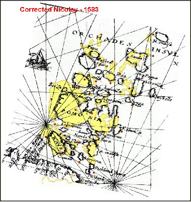
N de Nicolay - 1583
Vraye & exacte description hydrographique des costes maritime d’Ecosse, Isles Hebrides & Orchades
478
1 : 2,380,000
1 : 2,157,000
13.1