

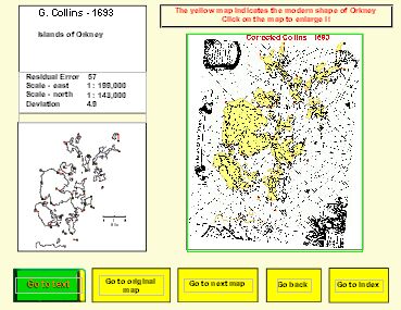
7. The Corrected Maps
Having determined possible sources of error in the original maps associated with incorrect scaling on both east-west and north-south directions, the images of the original map were scaled to adjust for these errors and for any associated with deviation of the map’s axis from true north. The resultant “corrected” maps are illustrated on a series of pages each one linked to the page illustrating the original map. The layout of the pages of corrected maps is shown below.
Name & Date
Map title
Illustration of corrected map with overlay of a modern outline in yellow.
Clicking on the map displays an enlarged version
Link to text relating to the map
Link to page showing the original map
Link to next map in the chronological sequence
Link to index of maps
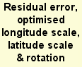
Error diagram
The red lines join real locations to squares at their positions on the old map
Individual original and corrected maps can be accessed through the Map Index button situated at the bottom left of this and other text pages and through links from the cartographers names in the following chronological discussions of the maps.
The “Next” button links to a discussion of an alternative method of comparing maps.
Corrected Map
Link to previous
map